
Voxer on the map: Where are you messaging from?
By TJ Cox, Data Scientist/Czar
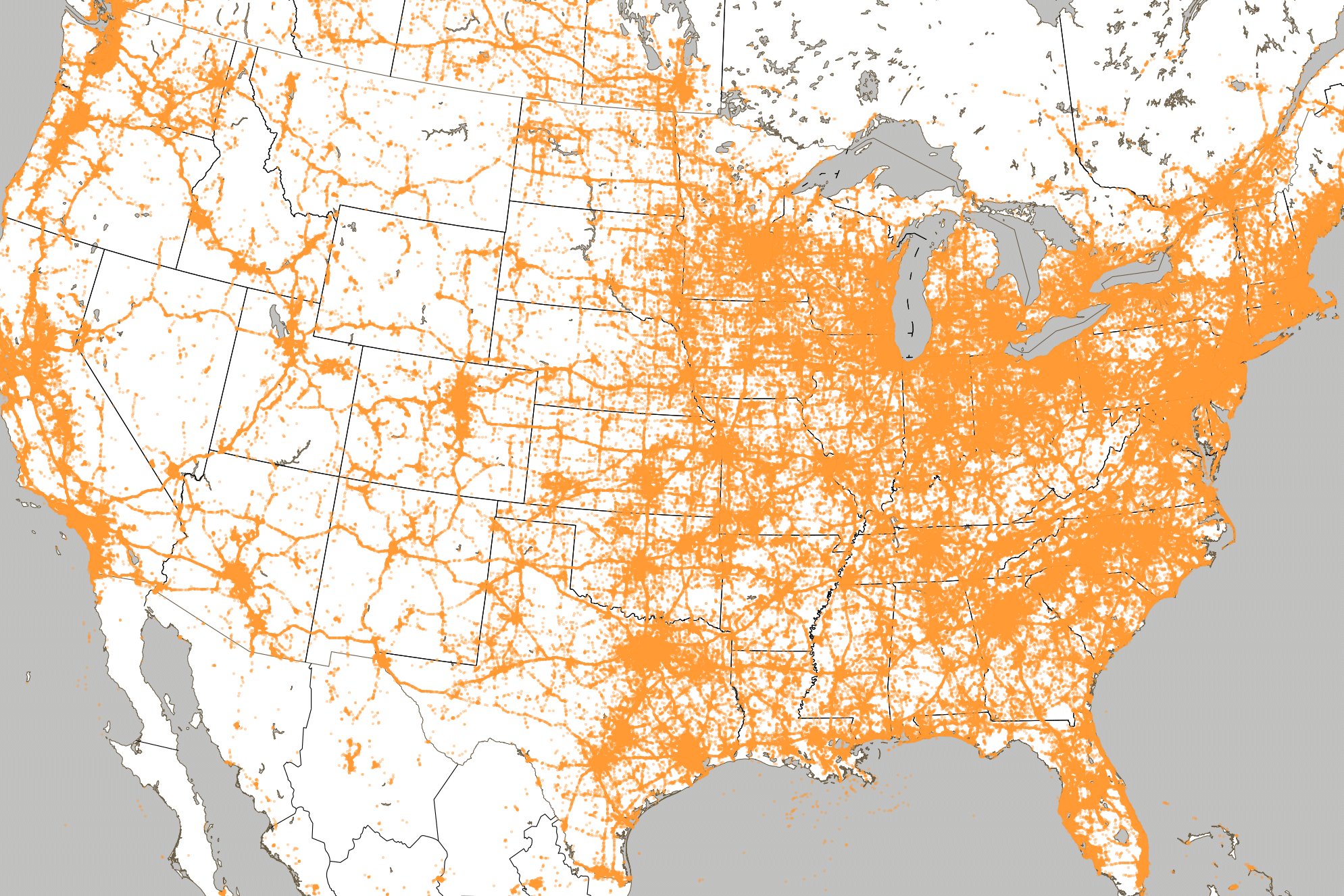
Where are you messaging from?
We at Voxer are constantly asking questions like this. How can we make our product better? Drum up push-to-talk business? What are the challenges that arise while messaging? But sometimes we’re just curious. (Everybody likes to look at pretty pictures of data, right?) This specific question came up recently as the Vox-office returned from the holidays. We regaled the usefulness of Voxer while connecting with family, organizing travel, or facilitating New Year’s festivities.
Using data to make a map.
To satisfy our curiosity we produced the above “Vox-map,” which shows the sending location of all Vox-messages during the holidays. Given the resolution of this image, where each pixel is approximately a square mile (~2 hundredths of a degree, or an arc-minute in latitude/longitude), places with many Voxer users become a sea of orange that closely resembles the overall population density. This image is very similar to satellite photos of the US at night (see Night Earth or this animation from NASA). Can you find where you live?
Voxer on the go?
What also appears is the American Highway system. The I-5 reaches from San Diego to Seattle, the 80 goes from SF to NY, and even Route 66 from LA to Chicago. Across the country, people are using the quick and efficient voice messaging provided by Voxer to connect with family and friends while on the go.

TJ Cox is a Data Scientist and Czar of the data world at Voxer, a recovering astrophysicist, a father, and (occasionally) a surfer.